CAD Viewer

For the field

GCC Field

Your drawings on your phone, with a dot showing where you’re standing.

Built for the people who never get handed the CAD file — owners, foremen, anyone who needs to know what’s where without opening AutoCAD. Install it once and it keeps working with no bars.

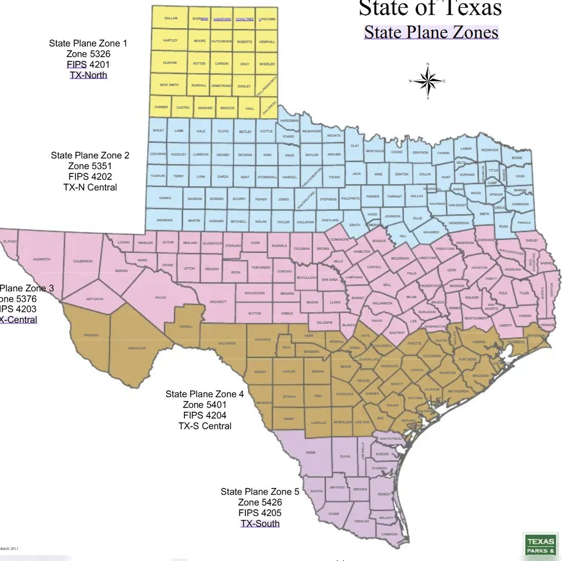
  1. Make a job. Name it, and find your county on the map to pick the zone.
  2. Add the drawing. Save the DXF to your phone, then tap Add DXF.
  3. Tap Find me. You show up on the drawing, with a circle showing how close the reading is.
  4. Tap anything. Its layer, length, bearing, and how far it is from you.
  5. Measure. Distances and areas, saved into the job.

Everything stays on your phone. Nothing is uploaded.

Only have a DWG?

The app reads DXF — the open format every CAD program can save. Ask whoever sent the file for “a DXF in state plane, US survey feet”, or send us the DWG and we’ll convert it free and send back a DXF that opens straight into the app.

Send us the DWG →

Open GCC Field
Put it on your phoneTakes about 20 seconds
gulfcoastcad.com/field
iPhone

Open that address in Safari. Tap Share at the bottom, scroll down, tap Add to Home Screen.

It has to be Safari. A link tapped from a text or email opens in a different browser that can’t install it.
Android

Open that address in Chrome. Tap the ⋮ menu, then Install app.
Drop a DXF or DWG below to open it in your browser — no software, no account, nothing stored. Click anything in a DXF to read its layer, length and bearing, measure distances and areas, see where you are standing on it, and orbit the linework in 3D.

Drop a DXF or DWG file to view

No install · Nothing stored

Uploading file…

DXF gets the full toolset — layers, click-to-inspect, measure, location and 3D. A DWG opens in Autodesk’s viewer instead, which hands back a finished picture rather than the geometry, so those tools can’t reach inside it. Send us the DWG and we’ll convert it free, or ask whoever sent it for a DXF.

In 3D: drag to orbit, two fingers to shift and zoom, or right-drag with a mouse.

Properties

Layers 0

Coordinate zone

Texas State Plane zones by county
DXF — instant

Parsed in your browser. Lines, polylines, arcs, circles, 3D faces and block inserts render immediately.

DWG — converted

Uploaded for translation, then streamed back to the viewer. Takes a moment on larger drawings.

Nothing kept

Files are used for the preview and discarded. No account, no install, no storage.

Got a site that needs modeling?

Send the plans. You’ll get a number back, usually same day.