GCC
GCC FieldJobs

Field

Your drawings, and where you're standing on them.

Works with no signal
No jobs yet Make one for the site you're headed to.
A job holds its drawings, its zone and its measurements.
No drawings yet Add a DXF from your email or files.
—

Install GCC Field
—

Layers

Measure

Tap two points on the drawing.

Coordinate zone

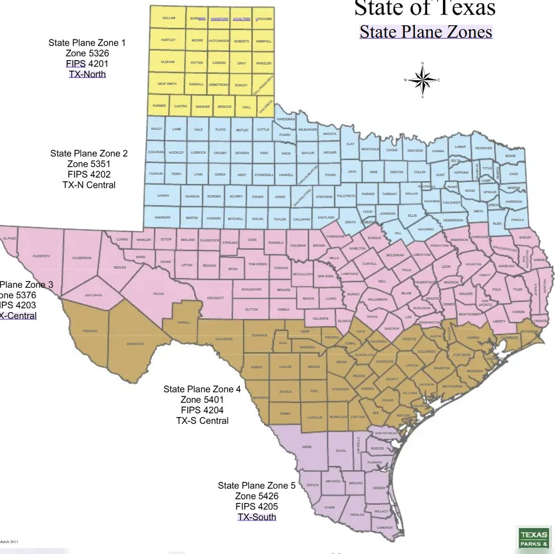
A DXF doesn't say where on earth it sits. Pick the zone your job is in and the app can put you on the drawing. Find your county on the map.
Texas State Plane zones by county
Check it against the drawing

New job

Find the county on the map below. Most of the Austin–San Antonio corridor is South Central; Austin itself is Central.

Texas State Plane zones by county

Measurements are in US survey feet.

That's a DWG

That file is a DWG. This app reads DXF — the open format every CAD program can save. A DWG is a sealed binary file, so no app can open it offline without a licence that costs thousands a year.

Two ways to get a DXF:

1 — Ask whoever sent it. Any surveyor, CAD tech or estimator can export a DXF in about ten seconds. Ask for "a DXF in state plane, US survey feet".
2 — Send it to us. We convert it free and send back a DXF that opens straight into this app, layers and elevations intact.
Email the DWG to us

Usually back the same day. No charge, no catch — we would rather you were using the app than stuck at this screen.